 The Wildebeest's guide to South Africa
Northern Cape towns
- Aansluit
- Aggeneys
- Andriesvale
- Carnarvon
- Douglas
- Groblershoop
- Komaggas
- Loeriesfontein
- Modder River
- Mount Rupert
- Noenieput
- Olifantshoek
- Orania
- Ritchie
- Soebatsfontein
- Strydenburg
- Union's End
- Vanderkloof
- Wallekraal
- Welverdiend
Aansluit
Aansluit is a tiny settlement in the Northern Cape.
It is situated near the Botswana border and near the confluence of the Kgokgole and Matlhwaring water courses.
The surrounding area is arid and rugged.
References and further reading
TopAggeneys
Aggeneys is a small town with a population of around 2,300 people.
The reason for the town being established in 1976 to service the mines in the area. Copper, zinc, silver and lead are mined nearby.
Aggeneys is situated in an arid region and gets some of its water pumped from the Orange River.
References and further reading
On Route - A region by region guide to South Africa - Author: B.P.J. Erasmus - Year Published: 1995 - Page: 341Southern Africa from the Highway - Author: AA RSA - Year Published: 1991 - Page: 281
Top
Andriesvale
Andriesvale is a small community near the southernmost point of the Kgalagadi Transfrontier Park
Andriesvale falls in the Mier Local Municipality which, in terms of population, is the smallest municipality in South Africa.
References and further reading
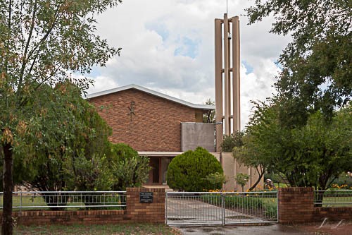
TopCarnarvon
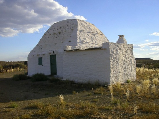
Corbelled House near Carnarvon
Photo © Johan van Zyl
Carnarvon is situated in the Karoo region of the Northern Cape province. It is surrounded by the low Karoo Hills.
The town has a chequered history and was originally known as Harmsfontein but it was renamed by the British to honour Lord Carnarvon who was the British Colonial Secretary.
Carnarvon has a lot of old houses and one can do the 'Historic Houses Trail'. One can also visit the Carnarvon Nature Reserve.
References and further reading
Book of the Road - 4th edition - Author: MapStudio - Year Published: 2019 - Page: 112Caravan & Outdoor Life - Issue 652 - Author: - Year Published: 2016 - Page: 57
Conolly's Guide to Southern Africa - Author: Denis Conolly - Year Published: 1982 - Page: 351
On Route - A region by region guide to South Africa - Author: B.P.J. Erasmus - Year Published: 1995 - Page: 307
Southern Africa from the Highway - Author: AA RSA - Year Published: 1991 - Page: 156
The Pictorial Motoring Atlas of South Africa - Author: Maxwell Leigh - Year Published: 1987 - Page: 50
Top
Douglas
Douglas
Photo © Johan van Zyl
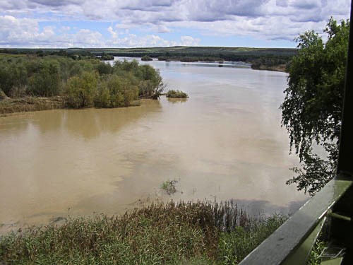
From a tourist point of view the most interesting thing about Douglas is that it is the site of the confluence of the Orange and Vaal Rivers.
The town itself is situated in a fertile farming area. Various crops are grown in the area and stock farming is also undertaken.
Douglas began its existence as a mission station. It was named after Sir Percy Douglas who was Lieutenant Governor of the Cape Colony.
Other attractions for visitors to this "oasis" in the Northern Cape are bird-watching, excellent fishing and glacial pavements.
References and further reading
Conolly's Guide to Southern Africa - Author: Denis Conolly - Year Published: 1982 - Page: 346On Route - A region by region guide to South Africa - Author: B.P.J. Erasmus - Year Published: 1995 - Page: 329
Reader's Digest Illustrated Guide to Southern Africa - 4th edition - Author: - Year Published: 1986 - Page: 172
The Pictorial Motoring Atlas of South Africa - Author: Maxwell Leigh - Year Published: 1987 - Page: 57
Top
Groblershoop
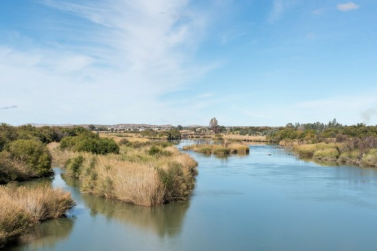
The Orange River with Groblershoop in the background
Photo © dpreezg - AdobeStock
Groblershoop is a small village situated near the Orange River in the Northern Cape.
It owes much of its existance to the construction of the Boegoeberg Dam, on the Orange River, which was completed in 1929.
The settlement was originally known as Sternham but was changed to Groblershoop in 1939. It was named after a former Minster of Land Affairs Piet Grobler.
The area around Groblershoop is known for its export quality table grapes and sultanas. Wine is also produced.
References and further reading
Conolly's Guide to Southern Africa - Author: Denis Conolly - Year Published: 1982 - Page: 347On Route - A region by region guide to South Africa - Author: B.P.J. Erasmus - Year Published: 1995 - Page: 332
Southern Africa from the Highway - Author: AA RSA - Year Published: 1991 - Page: 286
Top
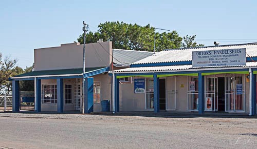
Komaggas

Komaggas
Photo © Johan van Zyl
Komaggas is a small settlement approximately 50 km west of the town of Springbok
Although the town is located near the Komaggas River it is a very dry region.
The town was founded as a mission station by the London Missionary Society in 1829. Today Komaggas is known for the quality of carpets produced.
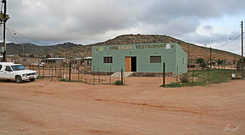
Restaurant in Komaggas
Photo © Johan van Zyl
References and further reading
On Route - A region by region guide to South Africa - Author: B.P.J. Erasmus - Year Published: 1995 - Page: 351Southern Africa from the Highway - Author: AA RSA - Year Published: 1991 - Page: 282
Top
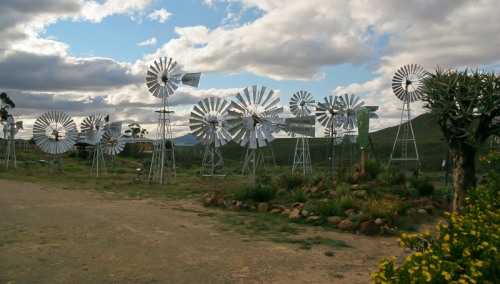
Loeriesfontein
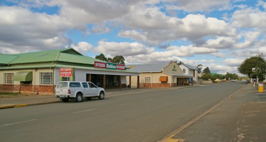
Loeriesfontein main street
Photo © Johan van Zyl
Loeriesfontein is a small town surrounded by mountains.
One of the interesting features of Loeriesfontein is the Windmill Museum featuring 27 windmills.
In spring the town plays host to visitors looking for the spring wildflowers.
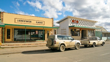
Loeriesfontein shops
Photo © Johan van Zyl
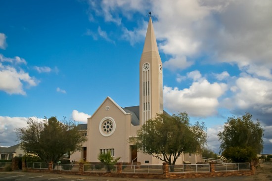
Dutch Reformed Church - Loeriesfontein
Photo © Johan van Zyl
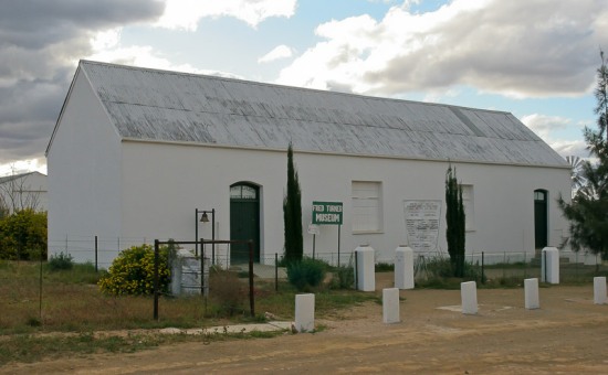
Fred Turner / Windpump Museum
Photo © Johan van Zyl
Windpump Museum
Photo © Johan van Zyl
References and further reading
On Route - A region by region guide to South Africa - Author: B.P.J. Erasmus - Year Published: 1995 - Page: 338Things ewe never kn'ewe about South African place names - Author: Ann Gadd - Year Published: 2015 - Page: 132
Top
Modder River - Afrikaans name: Modderrivier
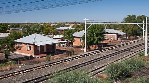
Modder River
Photo © Johan van Zyl
The little town of Modder River is situated near the point where the Modder River joins the Riet River. The Afrikaans word "modder" refers to "mud".
The town serves the local farmers who raise beef cattle and grow a number of crops under irrigation. A lot of grain is grown in the surrounding areas.
On 28 November 1899 a bloody took place in the area between the British and Boer forces. Lord Methuen led his British forces against the Boers led by General Piet Cronje. The British succeeded in driving the Boer forces back but both sides had many casualties.
Today one may visit a block house built by the British to guard the bridge over the river. It is a good example of these buildings which were built in many places around the country.
Shops in the town
Photo © Johan van Zyl
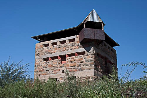
A block house from the Boer war
Photo © Johan van Zyl
References and further reading
TopMount Rupert
Above - Approaching Mount Rupert
Photo © Johan van Zyl
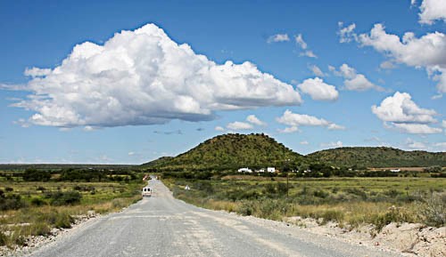
Mount Rupert is a small village in the Northern Cape province of South Africa. It is situated near the junction of the R370 and R371 roads.
There is a lot of mining in this area of the country and the Sover Diamond Mine is located next to Mount Rupert.
The climate in this region is hot and dry.
References and further reading
TopNoenieput
Noenieput is a tiny village that is one of the border posts between South Africa and Namibia.
The surrounding area is very arid.
References and further reading
On Route - A region by region guide to South Africa - Author: B.P.J. Erasmus - Year Published: 1995 - Page: 322Top
Olifantshoek
An elephant tusk was used to pay for the land on which the settlement of Olifantshoek was founded, and that is how it got its name.
Olifantshoek was founded in 1912.
Although the town is situated in a dry area there are a number of scenic and adventure attractions in the area. These include the Witsand Nature Reserve, San rock paintings and the Lange Mountains.
References and further reading
On Route - A region by region guide to South Africa - Author: B.P.J. Erasmus - Year Published: 1995 - Page: 323Southern Africa from the Highway - Author: AA RSA - Year Published: 1991 - Page: 160
Top
Orania
Orania
Photo © Johan van Zyl
The town of Orania has existed in a number of forms and names over the years. The origins of the town as it is now are from 1990 when a group of 40 Afrikaner families bought the town with a plan to establish a town to preserve the identity and culture of the Afrikaans community.
Orania only accepts new residents after going through an application process which has led to it being populated only by white people, virtually all of whom are Afrikaans. This has created a lot of attention to the town and it has had to fight off legal cases to preserve its identity.
Residents of Orania run a variety of businesses and a lot of farming activity takes place. There is a very large pecan nut plantation on the towns lands.
Succulent plants thrive in this semi-arid environment
References and further reading
On Route - A region by region guide to South Africa - Author: B.P.J. Erasmus - Year Published: 1995 - Page: 313Top
Ritchie
Ritchie
Photo © Johan van Zyl
Ritchie is a small town of around 15,000 people. It is located just off the N12 highway, in the Northern Cape province of South Africa, about 40 km south of Kimberley.
The town lies on the northern bank of the Riet River. The town serves the local farming industry which is mainly concentrated along the river.
Ritchie was originally called "The Rosmead".
Dutch Reformed Church
Photo © Johan van Zyl
References and further reading
On Route - A region by region guide to South Africa - Author: B.P.J. Erasmus - Year Published: 1995 - Page: 316Southern Africa from the Highway - Author: AA RSA - Year Published: 1991 - Page: 117
Top
Soebatsfontein
Soebatsfontein
Photo © Johan van Zyl
Soebatsfontein is a tiny village in a semi-arid area of the Northern Cape province in South Africa. It has a population of less than 300 people. The translation of the towns name from Afrikaans is 'fountain of pleading' which arose from a violent incident in the late 1890's. A farmworker was killed by San people even though he begged for his life.
The Skilpad Wild Flower Reserve is located nearby and is a great place to visit during the spring flower season.
Approaching Soebatsfontein
Photo © Johan van Zyl
References and further reading
On Route - A region by region guide to South Africa - Author: B.P.J. Erasmus - Year Published: 1995 - Page: 347Top
Strydenburg
The town of Strydenburg is situated in the Northern Cape province of South Africa.
It was established on the farm Roodepan in 1892. The story goes that there was a conflict over which farm the town should be established on and that gave rise to the name which means "town of argument" in Dutch.
The town has a population of around 3,000 people.
Strydenburg is situated in a semi-desert area and has particularly hot summers.
References and further reading
Conolly's Guide to Southern Africa - Author: Denis Conolly - Year Published: 1982 - Page: 347On Route - A region by region guide to South Africa - Author: B.P.J. Erasmus - Year Published: 1995 - Page: 309
Reader's Digest Illustrated Guide to Southern Africa - 4th edition - Author: - Year Published: 1986 - Page: 87
Southern Africa from the Highway - Author: AA RSA - Year Published: 1991 - Page: 116
Things ewe never kn'ewe about South African place names - Author: Ann Gadd - Year Published: 2015 - Page: 204
Top
Union's End
Union's End
Photo © Johan van Zyl
Unions End is more of a point on a map rather than a town. It is situated at the northern-most point of the South Africa side of the Kgalagadi Transfrontier Park.
At Unions End the countries of Namibia, Botswana and South Africa meet.
Unions End is situated in the Kgalagadi Transfrontier Park.
References and further reading
TopVanderkloof
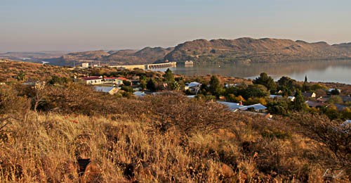
Vanderkloof
Photo © Johan van Zyl
The village of Vanderkloof was founded to provide accommodation and facilities for the workers involved in constructing the Vanderkloof Dam which, at the time, was called the P.K. le Roux Dam.
Vanderkloof is located on the southern shore of the dam near the giant dam wall.
The scenery in the vicinity is rugged, but picturesque. There is a lot for visitors to the area to do. Naturally the dam offers all the normal water sport activities. Other activities available include fly-fishing (below the dam wall), game viewing at Rolfontein Nature Reserve, rock-climbing, hiking and abseiling.
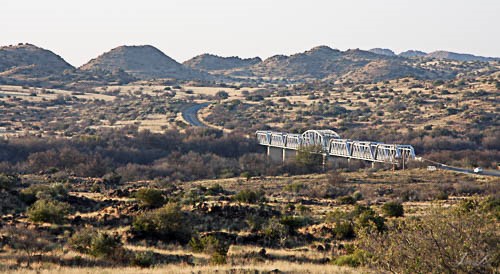
The Havenga Bridge over the Orange River
Photo © Johan van Zyl
References and further reading
On Route - A region by region guide to South Africa - Author: B.P.J. Erasmus - Year Published: 1995 - Page: 313Top
Wallekraal
Wallekraal area
Photo © Johan van Zyl
Wallekraal is a tiny settlement situated near the Spoegrivier in the Northern Cape province.
The surrounding area is semi-arid and covered with low scrub. The area comes alive during the spring flower season when the otherwise drab land has splashes of colour.
The settlement is near the Namaqua National Park on the road from Garies to Hondeklipbaai.
Surrounding area
Photo © Johan van Zyl
References and further reading
TopWelverdiend
Welverdiend, Northern Cape, is situated in the Kalahari Gemsbok National Park (which is part of Kgalagadi Transfrontier Park)
The town is a border post between South Africa and Namibia.
The town is the neighbour to Mata Mata rest camp in the Kgalagadi Transfrontier Park.
References and further reading
TopThis website features affiliate links, meaning we’ll earn a small commission if you purchase through these links.
Copyright Steven Herbert Projects, 2013 - 2023. All rights reserved.